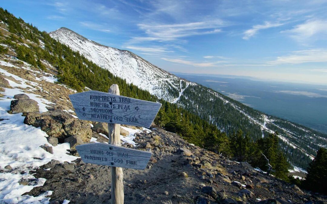
If you’ve spent any time in Flagstaff, Arizona, you know it’s a haven for all-things Microadventures: hiking, mountain biking, climbing, camping, backpacking, and more.
With miles of forests, canyons, mesas, and the San Francisco Peaks at your fingertips, there is no shortage of things to do in Flagstaff’s sunshine.
If you’re looking for some quick and easy things to do when visiting Flagstaff, hiking is the first activity that comes to mind.
However, with over 130 different hiking trails within the region, it can be difficult to pick a noteworthy trail to hike- especially if you don’t have a lot of time to spend.
That’s where we come in!
Here’s a brief list of our favorite hikes in Flagstaff, Arizona:
#10 Fat Man’s Loop
Fat Man’s Loop, despite the misleading name, is a great place for any hiker to get moving on the trails around Flagstaff! The busy trail runs about 2.5 miles round trip and can take just over an hour to hike.
Don’t expect to be alone on this trail! It’s a very popular hike for locals who are looking for a quick hike, jog, or walk with a dog.
Although parts of the hike can be quite rocky thanks to the winding trail, it is still a wonderful hike for those looking to experience what hiking in Flagstaff feels like. Along the way, you’ll have views of Mount Elden, high-desert trees and landscape, and views of eastern Flagstaff behind you.
Near the end of the trail (assuming you hike counter-clockwise), you’ll briefly emerge above the tree-tops with huge views of the Flagstaff cityscape and painted desert to the east.
#9 Summit Mount Elden via Elden Lookout Trail
This 6.5-mile hike is a perfect journey to the top of Elden mountain as you gain 2,300 ft. of elevation. The trail is considered moderately difficult, so we suggest that only experienced hikers tackle this one. In addition, start your hike early to avoid the heat and crowds. As you make your way up the mountain, you will catch a glimpse of emerald green aspens, vibrant wildflowers, and eastern Flagstaff at the foot of the peak!
#8 Lockett Meadow via the Inner Basin Loop Trail
One of the most popular trails to hike during Fall, Lockett Meadow is easily the best place to view the changing leaves in Flagstaff. The hike itself through the Inner Basin Loop Trail is an easy 3.5-mile stroll from the parking lot. Along the way, you’ll travel through several aspen tunnels, past two alpine lakes, and into the valley between the San Francisco Peaks.
Lockett Meadow is an absolute must hike for anyone visiting Flagstaff.
The trail is very popular during Fall. So much so that the Forest Service regulates the number of people hiking it. We advise you to get a very early start and try to hike during off-peak times of the week. If you try to hike the trail on a weekend in Fall, you’ll likely experience a line of cars waiting their turn to drive up to the meadow.
#7 Fisher Point via the Arizona Trail
Located in the southeastern wilderness of Flagstaff, Fisher Point is a beautiful overlook that sits off of the Arizona Trail. The trail via the Arizona Trail takes you through nearly 8 miles round trip with 1,000 feet of elevation gain, making for a steep yet pleasant hike along the way.
Hiking the trail to the top of Fisher Point, you’ll be greeted with the high desert flora of Flagstaff: ponderosa pines, aspens, juniper trees, and even small prickly-pear cactus. Standing at the top of Fisher Point, you can see part of the San Francisco Peaks to the north and the grassy meadows and rugged rock walls of Walnut Canyon to the south.
Hiking to Fisher Point is a great, decently full-day Microadventure that you can tack on as part of a longer hiking-focused trip in Flagstaff.
#6 Lower Oldham Trail
The Lower Oldham Trail is one of the best hikes that takes off from Buffalo Park. Lower Oldham is ideal for Microadventurers who are adamant about solitude and avoiding large crowds. Past the subdivisions that are adjacent to the trail, you’re likely to be alone the rest of the hike.
This moderate hike on Lower Oldham trail takes you 6.4-miles (round trip) through a deep forest of ponderosa pine trees and grey-colored basalt rocks. Along the way, you’ll have views of nearby Mount Elden and the smaller peaks south of the San Francisco Peaks.
We recommend you start your hike before sunset to get the best views of the fading light to the west.
#5 The Lava Tubes (Lava River Cave Trail)
Bet you didn’t think of caves when you thought of hiking in Flagstaff?
The Lava Tubes trail is perhaps one of the most unique hikes Flagstaff has to offer. The hike is composed of two caves that are connected via a single in-and-out entry. The caves themselves were created by a molten rock eruption that took place nearly 700,000 years ago and the subsequent “draining” of the lava that left behind these incredible caves.
The hike itself is short: just under a mile in length and is a great hike to cram in if you’re short on time.
The difficulty of the hike is really dependent on your strength. There is a little bit of scrambling as you descend into the cave from the entrance. After reaching the cave’s flat floor, there is at least one section where you’ll be required to crawl on all fours. The space isn’t terribly tight- unless your beer gut is on the bigger side. Regardless, hiking the Lava Cave Trail is a blast and one of the easiest cave hikes you’ll do outside of a major National Park.
Remember to wear shoes with good friction and clothes that will keep you warm, as temperatures at the floor of the Lava Tubes can drop into the 40’s even during the summer.
#4 Red Mountain Trail
Located on the outskirts of Flagstaff off of Highway 180 is one of the coolest trails in Northern Arizona. With the look and feel of a mini-Bryce Canyon, the Red Mountain trail sits on the foot of a sandstone amphitheater.
The trail itself is extremely easy to hike along. At just over a mile in length from the door of your car to the center of the amphitheater, the Red Mountain trail is a great place to hike if you’re short on time or looking to tack on a hike at the end of the day.
Fair warning: the hike out to the amphitheater isn’t terribly scenic- you’ll spend the whole hike in high desert brush with blocked views.
Once you get into the Red Mountain amphitheater, it’s a different story!
There are dozens of little slot canyons, hoodoos, and nooks to explore! The landscape feels truly “alien” compared to other hikes around Flagstaff. This fact and the amount of things to explore once you’re at the amphitheater is what gets the Red Mountain trail on our list.
#3 Summit the Doyle Saddle via Weatherford Trail
One of the most extravagant and challenging hikes in Flagstaff is the long and challenging 22 miles round trip up to the Doyle Saddle via the Weatherford Trail. The Doyle Saddle is the “saddle” between Doyle Peak and Fremont Peak.
Sitting at 11,464 feet, Doyle Peak is the 4th highest mountain in Arizona. This hike brings you within a half-mile of its summit.
This insane Microadventure weaves through a variety of terrain amounting to nearly 2,800 feet in elevation gain and is meant for only the most experienced hikers!
You may be asking yourself why to only hike to the saddle? Great question! In our experience, hiking to the summit of Doyle doesn’t allow you to get panoramic views of the western portion of Flagstaff and parts of the Coconino Forest and the San Francisco Peaks. Unfortunately, sitting at the summit of Doyle, those areas of Northern Arizona are blocked by Fremont Peak. The best views (in our opinion) are at the saddle between Doyle Peak and Fremont Peak.
Because of the roundtrip distance, we encourage you to begin super early and bring copious amounts of food, water, and sunscreen, as this Microadventure will take nearly 12 hours to complete.
Although the trail is indisputably difficult, it is certainly a spectacular way to spend a day amongst the beautiful scenery of Flagstaff and the San Francisco Peaks.
#2 Summit Humphrey’s Peak via the Kachina Trail
Located within the San Francisco Peaks is a challenging hike up to Humphrey’s Peak -the highest point in the beautiful state of Arizona. You’ll gain over 3,000 feet in elevation as you venture through a beautiful 10.5-miles (roundtrip) to the summit.
The first few miles are moderately easy as you hike through a dense ponderosa pine forest. Once you top out at the saddle, the hike gets a little more difficult. The climb is steeper and you’ll experience at least two false summits before topping out at the true one. The views from the summit are breathtaking. On clear days, you can see the Grand Canyon to the north and Sedona and the Mingus Mountain range to the south.
#1 Kendrick Peak Via the Kendrick Peak Trail
Be prepared for a long, but epic day!
Anyone who has driven from Flagstaff to the Grand Canyon has caught a glimpse of Kendrick Peak from Highway 180 and thought about hiking it. Fortunately, it’s a manageable (but long) hike up to the summit!
The epic 9.5-mile round trip hike enters from the south and traverses across a set of valleys before climbing the steep eastern face of Kendrick Peak. Fortunately, before hiking the eastern face, the hike up Kendrick Peak trail is relatively the same incline- but always in an upward direction!
Expect epic views of the San Francisco Peaks behind you as you hike up to the summit and a 360 view of mountains, valleys, and pine forests once you top out at the summit of Kendrick Peak.
We highly recommend this hike in Spring for the wildflowers or Fall for the incredible Fall colors in the Coconino National Forest.
Conclusion
With over 130 different hiking trails in and around Flagstaff, Arizona, it’s easy to become overwhelmed when choosing a place to hike for the afternoon.
You don’t want to risk hiking on a boring or not-so-scenic trail and miss out on the true hiking gems!
Fortunately, we have spent a considerable amount of time hiking around Flagstaff and have provided you with a list of our favorite trails around the area. Hopefully, our list has provided you with some bucket-list hiking trails and ideas on how to make the most of your Microadventure in Flagstaff.

